Modeling Spatial Accessibility to Parks in the City of Toronto
Abstract
This study demonstrates the spatial accessibility to parks using the concept of Population-Weighted Distance (PWD) to evaluate park access equity in the City of Toronto. The goal is to assess which neighborhoods are underserved in terms of spatial access to public parks and provide insights for urban planning and public health interventions.
Introduction
Parks are critical urban infrastructure for promoting physical activity, community engagement, and environmental well-being. Spatial accessibility to parks, especially in dense urban settings like Toronto, affects usage patterns and health outcomes. The PWD model is adopted to classify neighborhoods into five accessibility categories: Very High, High, Moderate, Low, and Very Low Accessibility.
Methodology
Tools Used for Analysis
- Python: For data processing and analysis.
- Folium: For creating interactive maps.
- Jupyter Notebook: For documenting the analysis process.
Data
- Neighborhoods: 140 Toronto neighborhoods with associated population data.
- Parks: Point locations of parks.
- Accessibility Metric: Population-Weighted Distance (PWD) in meters.
Parks data are extracted using API from Toronto Open Data Catalogue
Classification
PWD values were categorized as follows:
- Very High Accessibility: 0 - 300 meters
- High Accessibility: 301 - 600 meters
- Moderate Accessibility: 601 - 900 meters
- Low Accessibility: 901 - 1200 meters
- Very Low Accessibility: 1201 meters and above.
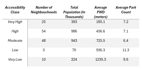
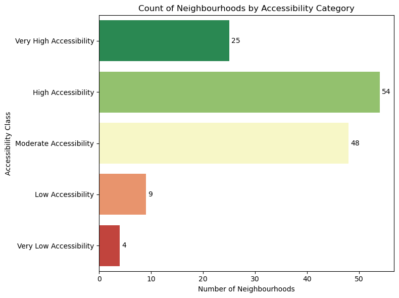
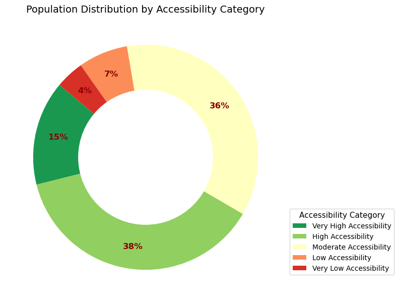
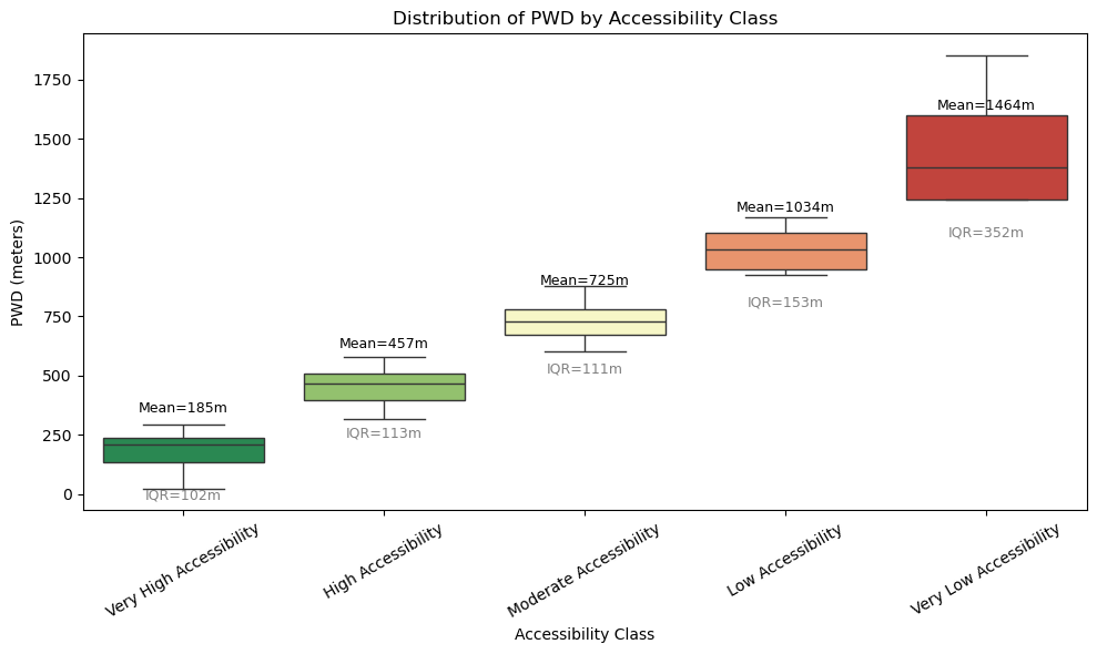
Results
Summary Statistics
Visualization
Discussion
The findings reveal that while many neighborhoods fall under "High" or "Very High" accessibility, there is a substantial population (over 290,000 people) residing in areas with Low or Very Low accessibility. Interestingly, these areas often have a significant number of parks, indicating that proximity, not quantity, is the limiting factor. This supports the conclusion that spatial distribution and connectivity matter more than raw counts.
The box plot highlights the variance within each class, reinforcing that some neighborhoods categorized under Moderate or even High accessibility may still be underserved compared to their peers.
Conclusion
Applying the PWD model in Toronto shows how nuanced park accessibility is. This spatial equity approach identifies not only areas with poor access but also informs where interventions like new park development or improved connectivity are most needed.
Recommendation
- Prioritize improving walkability and connectivity in "Low" and "Very Low" access zones.
- Consider population density in future park planning.
- Expand green infrastructure closer to underserved neighborhoods.